The Hidden Half of Infrastructure
NEW YORK STATE
Why is Hydrography so important to Engineering firms?
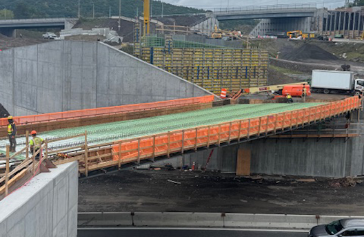
When people think about infrastructure projects, they often picture what is visible: bridges, piers, shoreline structures, and navigation channel markers. But for projects built near or over water, a significant part of the story exists where few people ever see it.
Below the surface.
As engineers and planners, we rely on accurate information to make good decisions. On land, gathering that information is relatively straightforward. Underwater, however, conditions can be far more complex and far less obvious. That’s where hydrographic surveying becomes essential.
Understanding What Lies Beneath
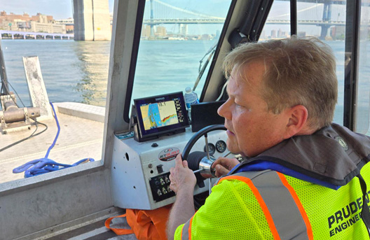
Hydrographic surveys allow project teams to see the underwater environment with clarity. Using modern sonar and positioning technology, we can map the bottom of rivers, lakes, reservoirs and coastal areas in detail. These surveys reveal underwater topography, sediment patterns, obstructions, and structural conditions that may not otherwise be apparent. For infrastructure projects, this information is not just helpful, it can be critical.
Bridge foundations, marine structures, and shoreline improvements all interact with the submerged environment. Without reliable data, teams are forced to make assumptions about conditions they cannot directly observe. Over time, those assumptions can lead to challenges during design, permitting, construction, or long-term maintenance.
A well-executed hydrographic survey replaces uncertainty with knowledge.
Supporting Smarter Engineering Decisions
One of the most valuable aspects of hydrographic surveying is the role it plays early in project development. When engineers have a clear picture of underwater conditions, they can design more effectively and anticipate potential risks before they become costly problems.
Hydrographic data can help teams:
· Identify scour or erosion concerns around existing structures
· Understand channel conditions and sediment movement
· Locate submerged debris or obstructions
· Monitor changes in riverbeds or lakebeds over time
· Support dredging, navigation, cable routing, intake/discharge pipe corridors, and shoreline planning
These insights help create a more complete understanding of the project environment and allow different disciplines to coordinate more effectively.
Technology Has Changed What We Can See
Advancements in hydrographic equipment have significantly improved the accuracy and efficiency of underwater data collection. Multibeam sonar, high-precision GPS positioning, and integrated data processing now allow survey teams to capture detailed models of the submerged landscape. For engineers and owners, this means better information and fewer surprises.
But technology alone is not the answer. Interpreting the data requires experience and an understanding of how underwater conditions influence infrastructure performance. Knowing what to look for, and what questions to ask, can make a meaningful difference in project outcomes.
Infrastructure Planning Is Stronger with a Complete Picture
Successful infrastructure projects rarely happen by accident. They are the result of careful planning, collaboration, and reliable information.
Hydrographic surveying provides a critical piece of that information. By understanding what lies beneath the waterline, teams can design more confidently, reduce risk, and support infrastructure that performs as intended for years to come. In many ways, the most important part of a project is the part people never see.
And that hidden half deserves just as much attention as everything above the surface.