Canalway Trail Rehabilitation
-
Project Type
Land Surveying
-
Date
2025
-
Location
Waterford, NY
-
Role
Deed and map research
Field reconnaissance, monument recovery
Instrument survey
ROW determination
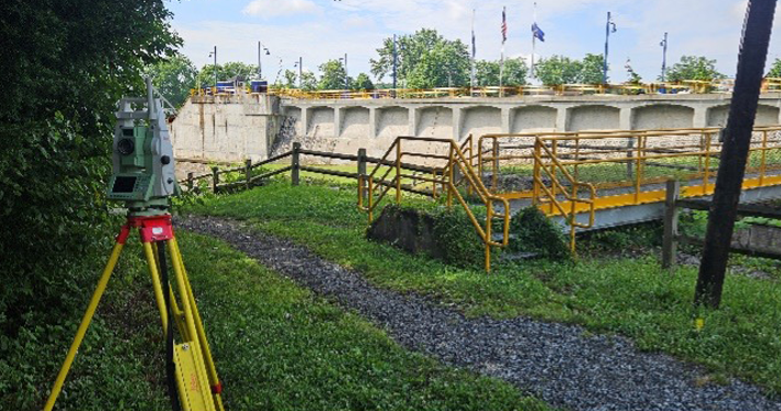
As part of broader efforts to preserve and enhance the historic Canalway Trail, Prudent Engineering was engaged as a subconsultant to help resolve long-standing property line questions in the Town of Waterford. This survey assignment focused on clarifying ownership and boundary details along segments of the Erie and Champlain Canals that border residential properties, including areas near Lock E-2 and the NYS Canal Corporation’s Waterford Shop access road on 9th Street.
Prudent’s survey team conducted deed and record title research, analyzing historic surveys and NYSCC Right-of-Way (ROW) and Abandonment Maps provided by the client. This research phase helped piece together the history of the corridor and established the foundation for field investigation.
Next, Prudent conducted a detailed instrument (field) survey and planimetric mapping, recovering existing boundary monuments and documenting visible features such as fences, guiderails, retaining walls, access roads, overhead utilities, and potential building encroachments.
Right-of-way and boundary line determinations were made as a result of analyzing all record title documents, field evidence, and ROW maps in accordance with the NYSDOT Land Surveying Section Standards & Procedures Manual and ROW Mapping Procedure Manual, and the NYSAPLS Code of Practice for Land Surveys.